I was traipsing through my hometown by satellite, using Google Earth to check out my high school, my mom's flower bed, and my first girlfriend's house. Suddenly I came across a graveyard, and with it, a long-suppressed memory of my sister Nadine slamming on the brakes, rushing to a grave, grabbing a bouquet of flowers, and then speeding off.
Yep. I come from the very finest stock available.
I want to share my favorite feature in Google Earth (which you can download for free here). You can turn on various "layers" that provide, among other things, labels and three-dimensional views. Combine that with the ability to change the angle of perspective, and you have something special. This morning I was zooming and panning all around Mount Everest, tracing the route all the way from Base Camp to the summit. It's easier to show you than to tell you. Click the thumbnails to open a larger version in a new window.
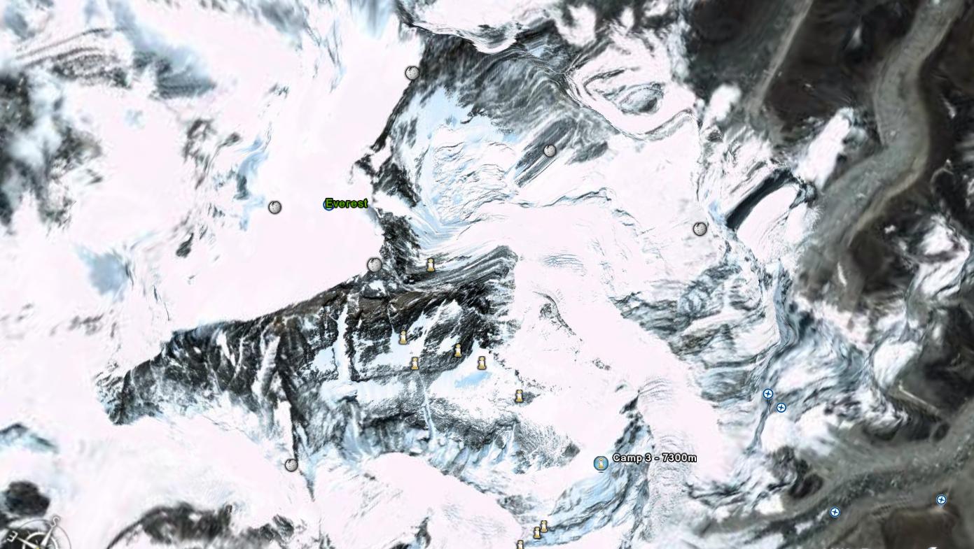
Here's the initial-bird's eye view of Everest. Note the position of Camp Three.
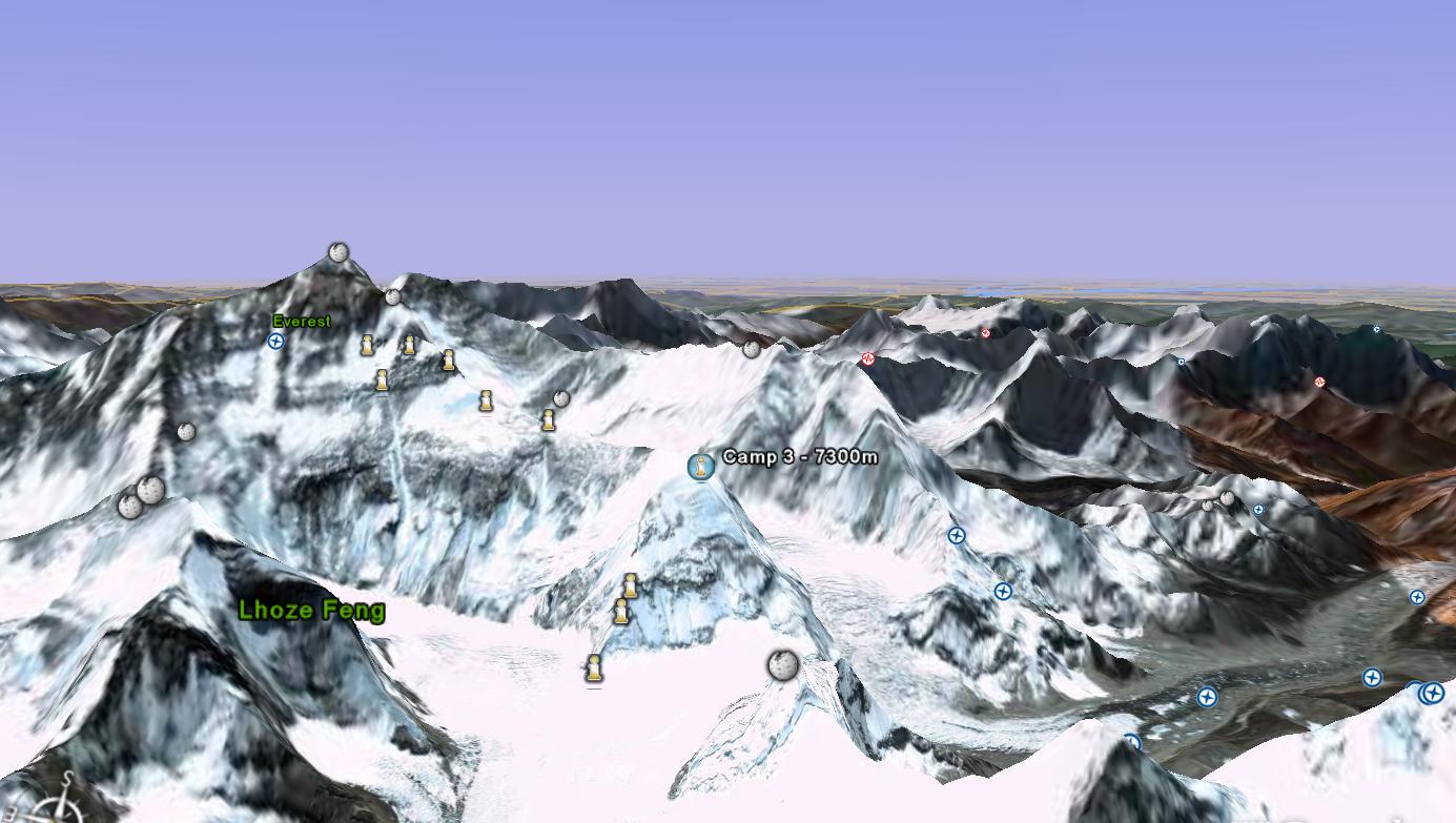
Here, I've lowered the perspective. My "camera" is now hovering above Base Camp and looking at the whole route, revealing the perch upon which Camp Three sits.
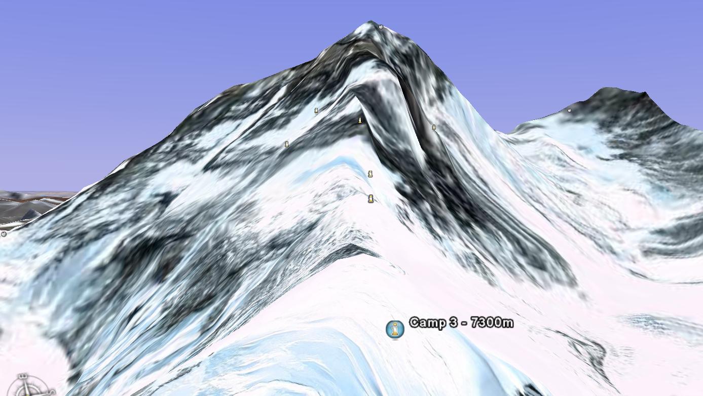
And here I've panned right, putting my "camera" at Camp Three and looking up the ridge to the summit.
Pretty cool stuff. The software is even able to represent the bluff visible from my house and approximate my view.
To replicate my Everest experience, turn on the Terrain and Geographic Web layers. To change the camera angle, use your mouse to wheel-click and drag. I'm not sure how you'd do it if you don't have a mouse with a wheel.